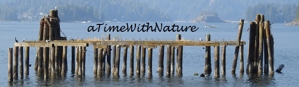
|
Home
|
||
| space | ||
| Lower Mainland Parks | ||
| space | ||
| The Lower Mainland is a region of south western British Columbia, which extends from Horseshoe Bay south to the U.S. border and east to Hope. It is home to about two million people. | ||
| space | ||
| In this area blessed with an abundance of natural settings, many opportunities exist for outdoor enjoyment. Please experience the following... at your leisure. | ||
| space | ||
Aldergrove |
Langley |
Richmond |
| Burnaby |
Maple Ridge |
Vancouver |
Coquitlam |
Port Moody |
North Vancouver |
Delta |
*** | West Vancouver |
| space | ||
Aldergrove
 Aldergrove Lake Regional Park
... Outdoor activities from walking, hiking trails, picnicking, or just plain relaxing.
Aldergrove Lake Regional Park
... Outdoor activities from walking, hiking trails, picnicking, or just plain relaxing.
This is a pleasant place to be!
Burnaby
 Barnet Marine Park
... A pleasant place to stroll, swim, and picnic.
Barnet Marine Park
... A pleasant place to stroll, swim, and picnic.
Makes for a great family outing!
 Burnaby Lake Regional Park
... Canoe or kayak, walk or jog, or just enjoy watching the birds and ducks... this is a pleasant place to be.
Burnaby Lake Regional Park
... Canoe or kayak, walk or jog, or just enjoy watching the birds and ducks... this is a pleasant place to be.
Keep an eye out for the busy beavers!
 Burnaby Mountain Park... Panaramic views of Vancouver,
the North Shore, and Indian Arm await you. Stroll through the Rose Garden, see the "Totem Poles" of the Japanese Ainu,
or enjoy splendid dining. All this, and more, are yours to experience at this leisurely setting near Simon Fraser University.
Burnaby Mountain Park... Panaramic views of Vancouver,
the North Shore, and Indian Arm await you. Stroll through the Rose Garden, see the "Totem Poles" of the Japanese Ainu,
or enjoy splendid dining. All this, and more, are yours to experience at this leisurely setting near Simon Fraser University.
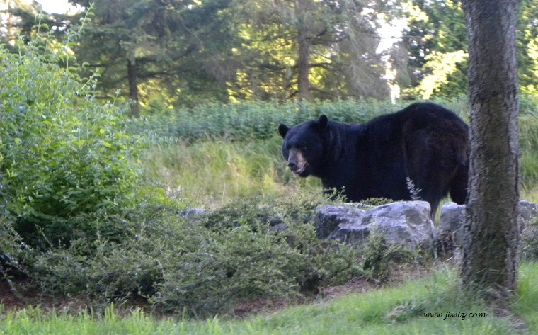
If hiking is more your mood, explore the many trails located in this Burnaby Mountain Conservation Area.
Bear! Where?
Location Map
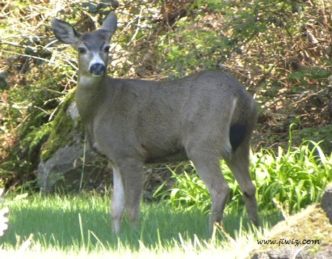
 Deer Lake Park... Intimate and peaceful, the trails in the City of Burnaby's
Deer Lake Park take visitors through cool woods, grassy meadows and lakeside vistas. Watch for a variety of bird life,
or enjoy the floral gardens.
Deer Lake Park... Intimate and peaceful, the trails in the City of Burnaby's
Deer Lake Park take visitors through cool woods, grassy meadows and lakeside vistas. Watch for a variety of bird life,
or enjoy the floral gardens.
Visitor Info
& Location Map
& Trail Map
 Fraser Foreshore Park... If a leisurely,
after dinner stroll on a level canopied trail, by a slow moving river, is what you’re looking for, Burnaby’s Fraser
Foreshore Park is for you. Relax and enjoy the cool breeze; watch the industrious tugs as they guide laden log booms to the
nearest saw mill; and, track the high, overhead jets as they make their way home to the Vancouver International Airport (as you
wonder from what exotic locale they are returning). Viewing a beautiful sunset will be an added bonus to your evening’s
enjoyment.
Fraser Foreshore Park... If a leisurely,
after dinner stroll on a level canopied trail, by a slow moving river, is what you’re looking for, Burnaby’s Fraser
Foreshore Park is for you. Relax and enjoy the cool breeze; watch the industrious tugs as they guide laden log booms to the
nearest saw mill; and, track the high, overhead jets as they make their way home to the Vancouver International Airport (as you
wonder from what exotic locale they are returning). Viewing a beautiful sunset will be an added bonus to your evening’s
enjoyment.
Location & Trail Map
Coquitlam
 Colony Farm Park... With an abudance of open fields and natural grasses, Colony Farm Park is a great
area for bird watching, perticularly hawks and herons.
Colony Farm Park... With an abudance of open fields and natural grasses, Colony Farm Park is a great
area for bird watching, perticularly hawks and herons.
 Minnekhada Park... This 200 hectare park, near the Pitt River in north east Coquitlam, features walking/hiking trails,
picnicking, a heritage site/building, and wildlife viewing.
Minnekhada Park... This 200 hectare park, near the Pitt River in north east Coquitlam, features walking/hiking trails,
picnicking, a heritage site/building, and wildlife viewing.
It is not at all unusual to see bear in this park.
 Mundy Park... An unexpectly secluded forrest in the middle of an urban area, Mundy Park has all the natural attributes that
you would expect, from hidden lakes to comfortable walking trails.
Mundy Park... An unexpectly secluded forrest in the middle of an urban area, Mundy Park has all the natural attributes that
you would expect, from hidden lakes to comfortable walking trails.
The only give-away that you are in the middle of an urban area (the city of Coquitlam) is the reqularly appearing red fire hydrants! They are quite surprising to see, and seem a bit out of place.
Located in west CoquitlamE641 Hillcrest Street
Delta
 Boundary Bay Regional Park... Surrounding Boundary Bay, this Important Bird Area
on the Pacific Flyway is a rest stop for thousands of migratory birds.
Boundary Bay Regional Park... Surrounding Boundary Bay, this Important Bird Area
on the Pacific Flyway is a rest stop for thousands of migratory birds.
Bring your binoculars, and enjoy!
 Boundary Bay's 12th Ave Dyke Trail... As part
of The Boundary Bay Regional Park, this section is especially blessed with an abundance of Northern Harriers.
Boundary Bay's 12th Ave Dyke Trail... As part
of The Boundary Bay Regional Park, this section is especially blessed with an abundance of Northern Harriers.
 Deas Island... This is where eagles soar, coyotes romp, and people stroll, picnic and relax in this oh so natural setting. Come and enjoy.
Visitor Info
& Location Map
& Trail Map
 The Reifel Bird Sanctuary... is the
winter home of the Lesser Snow Goose and one of Canada's top bird-watching sites in the heart of the Fraser River estuary,
one hour's drive from the City of Vancouver, British Columbia.
The Reifel Bird Sanctuary... is the
winter home of the Lesser Snow Goose and one of Canada's top bird-watching sites in the heart of the Fraser River estuary,
one hour's drive from the City of Vancouver, British Columbia.
Visitor Info & Map
Langley
 Campbell Valley Regional Park... Near 8th
Avenue and 200th Street, on Langley's southern boundary, this is a pleasant place for a walk, to watch the ducks, and to
picnic.
Campbell Valley Regional Park... Near 8th
Avenue and 200th Street, on Langley's southern boundary, this is a pleasant place for a walk, to watch the ducks, and to
picnic.
Makes for a great family outing!
 Derby Reach... On the shores of the Fraser River, west of Fort Langley, this GVRD park
offers an abundance of leisure activities, including fishing, picnicking, and camping. There are trails for hiking, cycling, and horse back riding.
Derby Reach... On the shores of the Fraser River, west of Fort Langley, this GVRD park
offers an abundance of leisure activities, including fishing, picnicking, and camping. There are trails for hiking, cycling, and horse back riding.
The site of the "first" Fort Langley is located in this park.
Maple Ridge
 Golden Ears Park... As one of the largest
parks in the province, Golden Ears Provincial Park is prized for its recreational opportunities. The extensive system of
trails within the park provides an excellent opportunity for hiking and horseback riding. Alouette Lake is a popular spot
for swimming, windsurfing, water-skiing, canoeing, boating and fishing. The park also has three large campgrounds. Natural
Features Vegetation is typical of the coastal western Hemlock forest of BC and the mountainous backcountry
is extremely rugged.
Golden Ears Park... As one of the largest
parks in the province, Golden Ears Provincial Park is prized for its recreational opportunities. The extensive system of
trails within the park provides an excellent opportunity for hiking and horseback riding. Alouette Lake is a popular spot
for swimming, windsurfing, water-skiing, canoeing, boating and fishing. The park also has three large campgrounds. Natural
Features Vegetation is typical of the coastal western Hemlock forest of BC and the mountainous backcountry
is extremely rugged.
Visitor Info
& Location Map
& Trail Map
 Kanaka Creek - Cliff Falls... a pleasant place to have a picnic, hike, or to simply enjoy nature.
 Kanaka Creek - Fish Fence...This is where returning Chum and Coho salmon are counted. Keep in mind that Black Bears like to count the fish too. Actually, they prefer to eat them :-) Keep your distance!
 Pitt Lake... On the southern shores of Pitt Lake, many areas are set aside for the enjoyment of nature.
Grant Narrows Regional Park offers a boat ramp and canoe rental facility, as well as a scenic view of the lake.
Canoeing, hiking, camping, animal watching and (of course) power boating & fishing on the lake, all await you... Enjoy!
 Rolley Lake... A pleasant place to camp, to fish, go boating, picnic, or to simply enjoy the water.
There is a handy beach to work on that tan!
Port Moody
 Belcarra Regional Park... Covering more than 1100 hectares in the Village
of Anmore, the Village of Belcarra and the City of Port Moody, Belcarra Regional Park is one of the largest parks in the GVRD system.
Belcarra Regional Park... Covering more than 1100 hectares in the Village
of Anmore, the Village of Belcarra and the City of Port Moody, Belcarra Regional Park is one of the largest parks in the GVRD system.
Visitor Info
& Location Map
& Trail Map
 Rocky Point Park... A pleasant place to stroll, hike, picnic, or to enjoy the sea.
Keep an eye out for the harbour seal!
Richmond
 Richmond's Gary Point Park...
for a pleasant stroll by the sea this is the place to be! It can become quite windy at this park,
so have a wind breaker handy. You may also want to bring a kite!
Richmond's Gary Point Park...
for a pleasant stroll by the sea this is the place to be! It can become quite windy at this park,
so have a wind breaker handy. You may also want to bring a kite!
This 39 acre waterfront park is at the mouth of the Fraser River and close to Steveston Village.
 Iona Beach Regional Park... Strolling along the beach,
bird watching, and hiking out to the point, are some of the things to enjoy at this near Vancouver International Airport location.
Iona Beach Regional Park... Strolling along the beach,
bird watching, and hiking out to the point, are some of the things to enjoy at this near Vancouver International Airport location.
Don't forget to take the short walk to see the activities on the nearby Fraser River.
 Richmond's South Dyke Trail...
for cycling, walking, and river watching, this is the place to be!
Richmond's South Dyke Trail...
for cycling, walking, and river watching, this is the place to be!
Visitor Info
& Map
 Steveston Fishing Village...
Features shops, markets, galleries, restaurants, Public Fish Sales Float, commercial boat tours and the Steveston Museum.
Steveston Fishing Village...
Features shops, markets, galleries, restaurants, Public Fish Sales Float, commercial boat tours and the Steveston Museum.
Gulf of Georgia Cannery... A national historic site and cannery commemorating the West Coast fishing industry with the use of themed exhibits. Guided and self-guided tours, programs and gift shop.
 Terra Nova Park... Richmond's Terra Nova Park, and adjacent West Dyke and Middle Arm Trails... nature at it's best! The West Dyke Trail connects Terra Nova Park with Garry Point Park.
The Middle Arm Trail is a 5.5 km dyke path adjacent to the Middle Arm of the Fraser River with views across to Sea Island, the Vancouver International Airport and the North Shore Mountains.
Vancouver
 Pacific Spirit Regional Park... From a walk in a deep lush forrest, to a picnic by the sea, Pacific Spirit Park offers this, and more.
With the University of British Columbia at it's north east, and the "clothing optional" Wreck Beach at it's west, varied recreational and educational opportunities abound!
 Queen Elizabeth Park... A flower lover's delight! This 52 hectare (130 acre) park is the highest point in the city, at 167m (505 ft) above sea level.
Check out the various lookout points for a 360 degree view of the city.
Queen Elizabeth Park... A flower lover's delight! This 52 hectare (130 acre) park is the highest point in the city, at 167m (505 ft) above sea level.
Check out the various lookout points for a 360 degree view of the city.
The Bloedel Conservatory... definately worth a visit. It is home to many colourful birds and exotic plants from around the world.
 Stanley Park... Walk, hike, drive, cycle, roller blade, jog... you can do it all in Stanley Park!
The Aquarium will bring out the fish lover in you!
 Vanier Park... Enjoy a leisurely stroll, a more vigorous walk or a jog, a visit to the Planetarium and the Vancouver Museum, or fly a kite! All this, and more, awaits you.
The Maritime Museum will bring out the seafarer in you!
North Vancouver
 Cleveland Dam... The source of Vancouver's water supply. Also, a pleasant place for a picnic, and a stroll.
Visitor Info
 Deep Cove - Quarry Rock... This is a 2 hour return, intermediate difficulty hike, with a 100 meters elevation gain.
Enjoy the view!
West Vancouver
 Ambleside Park... This is West Vancouver's best known park. Come and enjoy the sandy beach. Stroll it's pleasant path. See huge cruise ships
squeeze beneath Lion's Gate Bridge. Will they make it?
Ambleside Park... This is West Vancouver's best known park. Come and enjoy the sandy beach. Stroll it's pleasant path. See huge cruise ships
squeeze beneath Lion's Gate Bridge. Will they make it?
Visitor Info
 Lighthouse Park... This old-growth rain forrest on the shore of West Vancouver's Point Atkinson, provides a back drop for the lighthouse
beacon, as well as an opportunity to see "rather large" Douglas fir trees.
Lighthouse Park... This old-growth rain forrest on the shore of West Vancouver's Point Atkinson, provides a back drop for the lighthouse
beacon, as well as an opportunity to see "rather large" Douglas fir trees.